Lower Caragh Kayaking
* Freedom to ride
Kayaking
LOWER CARAGH
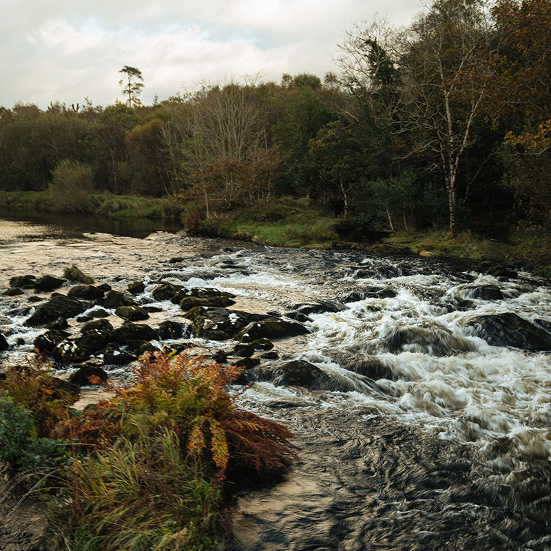
One of the most satisfying grade 2 kayaking routes can be found on the Lower Caragh, which runs alongside the Kerry Way walking trail and provides a different perspective of the mountain views.
The river winds its way through a series of great meanders towards the wild Atlantic, right below the steep slopes of Seefin and Commaun, and offers a series of different challenges throughout including stoppers, wave trains, eddies, pour-overs, deep pools and technical rapids. Please note that while the River Caragh is open to all, the lands surrounding the river are privately owned and managed by fisheries.
It is important to maintain mutual respect between kayakers and fishermen so that access to the river can be enjoyed by everyone.

THE RIDE
- Duration: 3 hours
- Length: 4km
- Route Type: Point to point
- Category: Scenic
Small but perfect
The Lower Caragh runs for 4km from Caragh Lake to the ocean at Dooks and has every feature you'd want at grade 2.
Public access
The easiest and safest way to enter the water is at the public access point on Caragh Lake. A short paddle leads to the river itself.
Historic bridge
The Lower Caragh passes under a six-arch rubble stone road bridge that dates from the early 19th century.
Spectator point
Just past a second bridge at Quaybaun is a viewing point over the River, perfect for those who want to watch the fun from dry land.


FAQ
This 5km long stretch of soft sand and wild dunes is ideal for summer and winter walks, as well as being a long-standing favourite for swimmers and surfers
RELATED TOURS
Escape to the Heart of the Kingdom, home to Ireland’s highest mountains, darkest skies and cleanest air
FOOD & DRINK NEARBY
Escape to the Heart of the Kingdom, home to Ireland’s highest mountains, darkest skies and cleanest air
#ReeksDistrict
We love seeing what you get up to. Share your #ReeksDistrict photos and tag @reeksdistrict to be featured
