

$45
/person25% Off
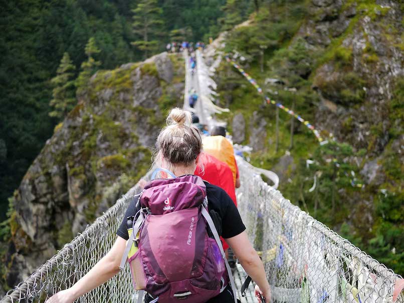
Suspension Bridge
Quisque cursus finibus lectus, at dignissim mi congue ac.
This world-famous long-distance (214 km) walking trail is the on-foot version of the Ring of Kerry, a huge looped route around the Iveragh Peninsula taking in some of the Reeks District and Kerry’s finest sights on the way.
In the Reeks District, you can pick up the Kerry Way in the Black Valley and walk toward Glencar, or even choose to start from the Climbers Inn or Glenbeigh. Although the trail goes through many remote locations, walkers can book accommodation in guesthouses along the trail or in nearby villages close to the route.
While the Reeks District is home to Ireland’s highest mountains, the Kerry Way avoids the higher peaks and takes walkers on the lower reaches of mountain ridges offering a variety of landscapes on the way. Reeks highlights on the trail include the Black Valley, Lough Acoose, Glencar and Cahersiveen, while other notable stops are Killarney National Park and the town of Waterville that overlooks Ballinskelligs Bay.
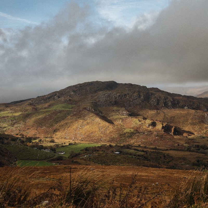
Looping around the Iveragh Peninsula, the Kerry Way passes through some of the most isolated and dramatic countryside in Ireland.
Certain parts of Kerry are Irish speaking (Gaeltacht) so you may see signs with different spellings for place names depending where you are on the route.
Boggy farmland, long-abandoned coach roads, soft trails and ancient paths – the terrain on the Kerry Way is as varied as it comes.
Despite its remote nature, the Kerry Way passes through enough towns and villages to make refeshment and overnight relaxation easy to find.
The following are recommended: comfortable walking/hiking boots and socks, head covering, gloves, fleece, waterproof jacket and over-trousers.
Yes, but a guidebook and maps are recommended. Maps numbered 78, 83 and 84 in The Discovery Series produced by Ordnance Survey Ireland are the best ones.
Reception on high ground is pretty good, but less so in the valleys. Don’t rely on a map on your phone to always work.
We love seeing what you get up to. Share your #ReeksDistrict photos and tag @reeksdistrict to be featured

We are a co-operative of 100+ small Irish family businesses. Supporting this project helps support both our region and all our members.
The Reeks District is a not-for-profit organisation that includes 100+ small local businesses. By visiting us, you help support both our region and all our members.
| Cookie | Duration | Description |
|---|---|---|
| cookielawinfo-checkbox-advertisement | 1 year | Set by the GDPR Cookie Consent plugin, this cookie is used to record the user consent for the cookies in the "Advertisement" category . |
| cookielawinfo-checkbox-analytics | 11 months | This cookie is set by GDPR Cookie Consent plugin. The cookie is used to store the user consent for the cookies in the category "Analytics". |
| cookielawinfo-checkbox-functional | 11 months | The cookie is set by GDPR cookie consent to record the user consent for the cookies in the category "Functional". |
| cookielawinfo-checkbox-necessary | 11 months | This cookie is set by GDPR Cookie Consent plugin. The cookies is used to store the user consent for the cookies in the category "Necessary". |
| cookielawinfo-checkbox-others | 11 months | This cookie is set by GDPR Cookie Consent plugin. The cookie is used to store the user consent for the cookies in the category "Other. |
| cookielawinfo-checkbox-performance | 11 months | This cookie is set by GDPR Cookie Consent plugin. The cookie is used to store the user consent for the cookies in the category "Performance". |
| CookieLawInfoConsent | 1 year | Records the default button state of the corresponding category & the status of CCPA. It works only in coordination with the primary cookie. |
| elementor | never | This cookie is used by the website's WordPress theme. It allows the website owner to implement or change the website's content in real-time. |
| PHPSESSID | session | This cookie is native to PHP applications. The cookie is used to store and identify a users' unique session ID for the purpose of managing user session on the website. The cookie is a session cookies and is deleted when all the browser windows are closed. |
| viewed_cookie_policy | 11 months | The cookie is set by the GDPR Cookie Consent plugin and is used to store whether or not user has consented to the use of cookies. It does not store any personal data. |
| Cookie | Duration | Description |
|---|---|---|
| _ga | 2 years | The _ga cookie, installed by Google Analytics, calculates visitor, session and campaign data and also keeps track of site usage for the site's analytics report. The cookie stores information anonymously and assigns a randomly generated number to recognize unique visitors. |
| _gat_gtag_UA_113644918_1 | 1 minute | Set by Google to distinguish users. |
| _gid | 1 day | Installed by Google Analytics, _gid cookie stores information on how visitors use a website, while also creating an analytics report of the website's performance. Some of the data that are collected include the number of visitors, their source, and the pages they visit anonymously. |
| _hjAbsoluteSessionInProgress | 30 minutes | Hotjar sets this cookie to detect the first pageview session of a user. This is a True/False flag set by the cookie. |
| _hjFirstSeen | 30 minutes | Hotjar sets this cookie to identify a new user’s first session. It stores a true/false value, indicating whether it was the first time Hotjar saw this user. |
| _hjIncludedInPageviewSample | 2 minutes | Hotjar sets this cookie to know whether a user is included in the data sampling defined by the site's pageview limit. |
| _hjIncludedInSessionSample | 2 minutes | Hotjar sets this cookie to know whether a user is included in the data sampling defined by the site's daily session limit. |
| Cookie | Duration | Description |
|---|---|---|
| NID | 6 months | NID cookie, set by Google, is used for advertising purposes; to limit the number of times the user sees an ad, to mute unwanted ads, and to measure the effectiveness of ads. |
| Cookie | Duration | Description |
|---|---|---|
| _hjSession_2843468 | 30 minutes | No description |
| _hjSessionUser_2843468 | 1 year | No description |